Planning a new route
To start planning the route click the Add new route button;
The “New route creation” window will be displayed;

Leave “Create from scratch” marked, name the route, select the vehicle profile, and press “Next”;
Use the Quick Search option for faster navigation:
• Click the search window;
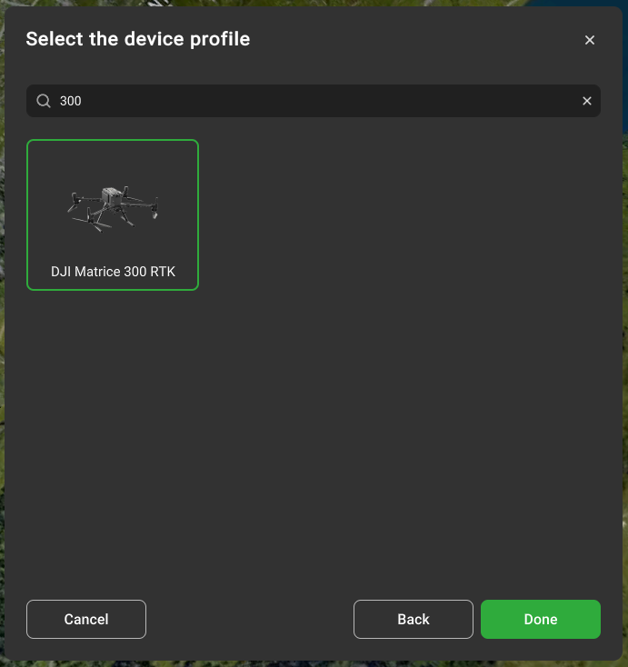
• Start typing the drone name/model;
• Select the required drone;
• Click next.
Leave the default parameters at the last step.
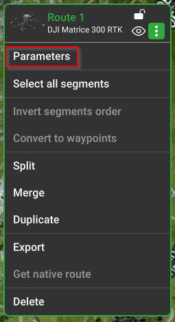
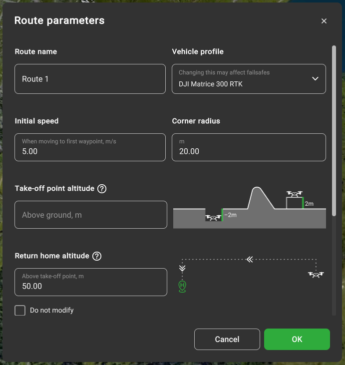
More information about this window can be found in the section “Route parameters”. To create a route with the provided settings click “Ok”. A new route card will be displayed with the specified name;
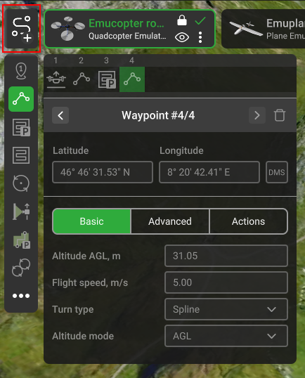
Select any of the Flight planning tools and add segments on a map by double-clicking or “SHIFT+left click”. Each Route's planning tool has an associated inspector window enabling to adjust parameters like coordinates, altitude, speed, etc., that will be considered during the calculation process. Also, the turn type and camera action settings can be adjusted;
The path-finding algorithm of UgCS will automatically start the calculation of the flight path in a few seconds after the user stops editing the route. The status of the calculation will be displayed as the Route’s calculation indicator on the Route’s card;
When the route is successfully calculated (green checkmark) it can be Uploaded to the vehicle.
To take off, Arm the vehicle and turn on Auto flight mode.
IMPORTANT! Operation procedures differ for each vehicle type. E.g. some of them may start from the ground, others require manual take-off to a safe altitude. Please read carefully the vehicle operation guide and UgCS “How to connect…” manuals. Pilot MUST know how to act in emergencies at all times.
Note: safety is always the responsibility of the pilot!!!
Updated about 2 months ago