Altitude modes
There are four main altitude references used throughout the UgCS system.
AMSL
Height above mean sea level (AMSL) is the elevation (on the ground) or altitude (in the air) of an object, relative to the average sea level datum.
AGL
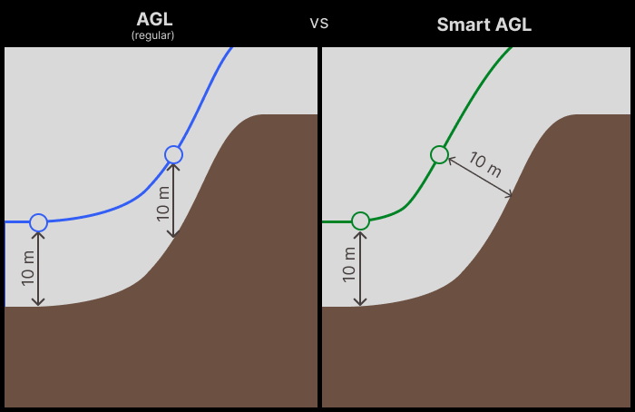
Height is measured with respect to the underlying ground surface. This is as opposed to altitude/elevation above mean sea level (AMSL)
Smart AGL (available ONLY with UgCS EXPERT and UgCS ENTERPRISE licenses)
Smart AGL altitude mode allows the drone to keep a constant distance to the nearest surface on the flight line (instead of vertical distance to the ground like in regular AGL mode), making flights over steep terrain safer.
Smart AGL is set as the default option under the Altitude mode parameter in all flight planning tools.
Smart AGL also changes the behavior of flight paths in survey side movement segments and overshoots - terrain following is now utilized in these parts of the route as well.
RANGEFINDER
This altitude type is available for Ardupilots vehicles and for DJI M300, and DJI M350.
Updated about 2 months ago