Area scan

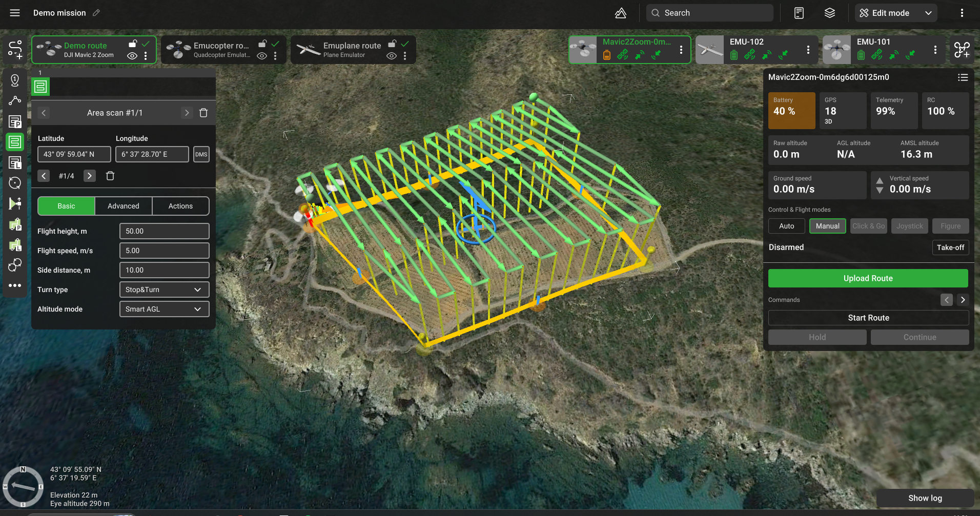
Area scan flight plan
Area scan is similar to a Photogrammetry tool, except for Area scan there is no need to set the Ground resolution (GSD) and camera settings. This is a simpler way to plan flights over an area. Parameters to specify height, side distance, and perimeter.
Additionally to all standard options, these features are available for the Area scan tool:
Basic
Flight height altitude of flight along the area.
Side distancesize in meters between lengthwise route lanes.
Altitude mode AMSL, AGL, Smart AGL, or Rangefinder to set Flight height.
Advanced

AGL Tolerance (m) – allows flying straight trajectories over the slightly waved landscape, by specifying how precisely the UAV should follow the required altitude above ground. To maintain a defined height additional waypoints will be added if the height difference is larger than the AGL tolerance. The smaller the AGL tolerance value, the more amount of waypoints will be generated. If AGL tolerance is set to 0 (zero) UAV’s altitude will be constant throughout the route, but many additional waypoints will be added.
Direction angle changes the direction of the main scanning progress. By default, the algorithm calculates a route scan in a bounded polygon so that the main course of the scan is performed in the direction of "South-North".
Overshoot (m) adds an extra segment to both ends of each survey line to enable extra space for turns.
Overshoot speed (m/s) option to decrease/increase vehicle speed for overshoot segment while passing turns.
Double grid if enabled, add a second grid to the survey at a 90-degree angle according to the first grid.
Allow partial calculationoption to allow route calculation in these cases:
a. The part of the route exceeds the maximum AMSL of route
b. Relief height is unavailable at some point(s) of route
c. The part of the route exceeds the maximum fence radius
d. The part of the route in the No-fly zone (NFZ)
A calculation error may appear if the trajectory fixed height is lower than the safe height over terrain at some route point.
No action at the last point removes action for the last waypoint.
To Move / Rotate segment select + hold the blue circle in the center to drag and drop the Area scan segment to another location. Select + hold the circle’s rim to rotate the whole segment.
Updated about 2 months ago