3D Objects (vector layers)
UgCS allows adding custom 3D objects or vector layers to display them on the map of UgCS and to consider it when the route is calculated.

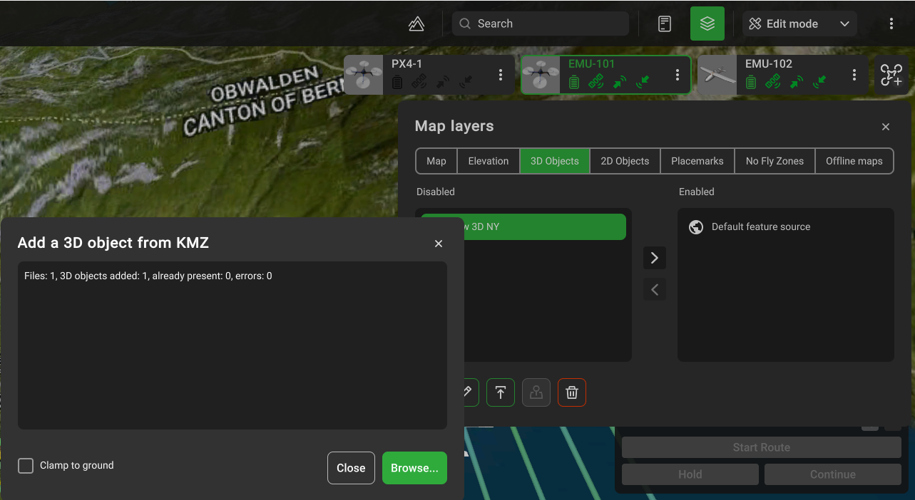
UgCS supports the import of *.KMZ files.
*.KMZ file must be legacy (ZIP 2.0) compression compatible. The contents of a KMZ file are a single root KML document (notionally "doc.kml") and optionally any overlays, images, icons, and COLLADA 3D models referenced in the KML including network-linked KML files. The root KML document by convention is a file named "doc.kml" at the root directory level, which is the file loaded upon opening. By convention, the root KML document is at the root level, and referenced files are in subdirectories (e.g. images for overlay images).
3D building models import:
- Click the Map options (globe icon at the top right-hand corner of the screen);
- Click the Map layers button;
- Select the 3D objects tab;
- Add a unique name and upload a 3D model via the “upload” button. Browse for the uploaded models in KMZ format.
It is possible to change the models from enabled to disabled source list.
The «Focus» button will display the region of the map of the imported object.

Import with option "Clamp to ground":
When this option is enabled, the model will be forcedly placed at the ground level of the center point of the model from the corresponding elevation profile. The values of the AltitudeMode and Altitude parameters in the KML file will be ignored;
The elevation of the object inside the 3D model should be equal to 0 (the object should be located on the floor of the model);
One model should represent one object on the map (one building). In case the 3D model represents some set of map objects (several buildings) - the surface of the earth onto which these models are imported should be a flat surface. Otherwise, some objects may appear above or below the ground.
Import without option "Clamp to ground":
If the AltitudeMode parameter in the KML file is set to clampToGround, then the model must meet the requirements described in paragraph 1;
The recommended value for AltitudeMode: is absolute.
The altitude value of the model in the KML file must be correctly set, according to the AMSL elevation of the area from the corresponding elevation profile;
The elevation of the object inside the 3D model should be equal to 0 (the object should be located on the floor of the model). Otherwise, the model altitude in the KML file should be set with an offset corresponding to the elevation of the object inside the 3D model.
In case the 3D model represents some set of map objects (several buildings) - the elevation of each object inside the 3D model must be set with an offset so that the objects correctly follow the ground contour for the corresponding elevation profile. The best approach, in this case, is to either set the altitude of the model in the KML file to 0, and set the appropriate AMSL elevation for each object inside the 3D model or split such model into several models, each of which contains one map object.

Updated about 2 months ago